
This repository contains an archival copy of the Albers.gdb.zip dataset, originally distributed by the National Drought Mitigation Center (NDMC) at the University of Nebraska, Lincoln. The NDMC stewards the US Drought Monitor, a weekly assessment of drought conditions in the United States and outlying territories.
Download Script
This is the script used to acquire the archived geodatabase. It is not evaluated when this README is knit, so that knitting never overwrites the archived artifact.
install.packages("curl")

## Download the NDMC Albers.gdb.zip file
curl::multi_download("https://droughtcenter.unl.edu/Outgoing/Albers.gdb.zip",
                     "Albers.gdb.zip")
📦 Dataset Overview
- Title: Albers.gdb
- Source: National Drought Mitigation Center (NDMC), University of Nebraska–Lincoln
- Format: ESRI File Geodatabase (.gdb), USA Contiguous Albers Equal Area Conic projection (ESRI:102003)
- Original Distribution: https://droughtcenter.unl.edu/Outgoing/Albers.gdb.zip
- Distribution Type: Public archival for research and historical purposes
- Date of Archive: 2025-06-06
📂 Contents
The zipped geodatabase contains ten county-boundary layers (all with a 2021 vintage in their names) reportedly used by the NDMC in producing weekly US Drought Monitor county statistics and map products. This repository provides:
Albers.gdb.zip– The original NDMC File Geodatabase, archived unmodifiedndmc-counties-albers.R– R script that downloads the geodatabase from the NDMC server
Layers in the geodatabase:
| Layer | Geometry |
|---|---|
counties_detailed_all_2021 |
Multi Polygon |
counties_detailed_stats_2021 |
Multi Polygon |
counties_detailed_total_2021 |
Multi Polygon |
counties_detailed_usvi_2021 |
Multi Polygon |
counties_simp_all_2021 |
Multi Polygon |
counties_simp_total_2021 |
Multi Polygon |
counties_simp_total_2021_1 |
Multi Polygon |
counties_simp_json_2021 |
Multi Polygon |
counties_simp_usvi_2021 |
Multi Polygon |
counties_simp_total_inner_2021 |
Multi Line String |
The detailed layers carry full-resolution boundaries; the simp
layers are simplified variants. The NDMC has not published documentation
of the layers’ intended uses.
🧾 Field Descriptions
Fields of the primary layer, counties_detailed_all_2021 (3,264
features covering all states and territories):
| Field Name | Description |
|---|---|
CountyFIPS |
A five-digit FIPS state and county code |
CountyName |
The county name |
StateFIPS |
A two-digit FIPS state code |
StateAbbr |
A two-letter USPS abbreviation for the state |
ISCONUS |
YES/NO — whether the county lies within the contiguous US |
ISTOTAL |
YES/NO flag; purpose not documented by the NDMC |
WKID |
Well-known ID of the layer’s coordinate reference system |
Shape_Length |
The polygon edge length in meters |
Shape_Area |
The polygon area in square meters |
🛠️ How to Use
- Unzip the
Albers.gdb.zipfile. - Open the
Albers.gdbgeodatabase in a GIS software environment such as QGIS or ArcGIS Pro. - Use the layer properties to explore attributes and spatial coverage.
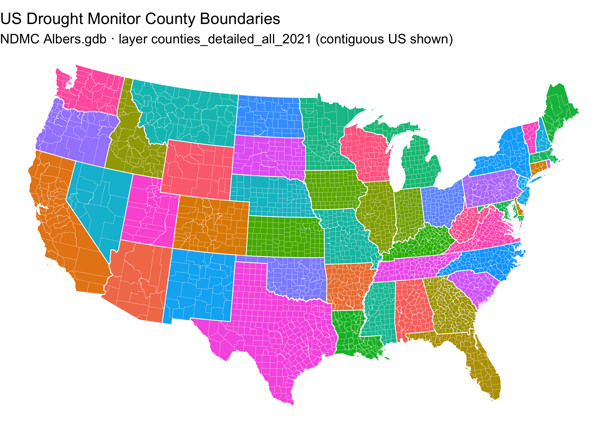
📍 Quick Start: Visualize the Albers.gdb county boundaries in R
This snippet shows how to read the counties_detailed_all_2021 layer
directly from the archive and create a simple map using sf and
ggplot2.
# Load required libraries
library(sf)      # For spatial data
library(ggplot2) # For plotting
library(dplyr)   # For data manipulation

## Read the primary layer from the archived NDMC geodatabase
counties <-
  sf::read_sf("/vsizip//vsicurl/https://data.sustainable-fsa.com/ndmc-counties-albers/Albers.gdb.zip",
              layer = "counties_detailed_all_2021") |>
  dplyr::filter(ISCONUS == "YES")
## Warning in CPL_read_ogr(dsn, layer, query, as.character(options), quiet, : GDAL
## Message 1: organizePolygons() received a polygon with more than 100 parts.  The
## processing may be really slow.  You can skip the processing by setting
## METHOD=SKIP. Further messages of this type will be suppressed.

## Warning in CPL_read_ogr(dsn, layer, query, as.character(options), quiet, : GDAL
## Message 1: organizePolygons() received a polygon with more than 100 parts. The
## processing may be really slow.  You can skip the processing by setting
## METHOD=SKIP, or only make it analyze counter-clock wise parts by setting
## METHOD=ONLY_CCW if you can assume that the outline of holes is counter-clock
## wise defined. Further messages of this type will be suppressed.
states <-
  counties |>
  dplyr::group_by(StateFIPS) |>
  dplyr::summarise(.groups = "drop")

# Plot the map
ggplot() +
  geom_sf(data = counties,
          aes(fill = StateFIPS),
          color = "white",
          linewidth = 0.05,
          show.legend = FALSE) +
  geom_sf(data = states,
          fill = NA,
          color = "white",
          linewidth = 0.3) +
  labs(title = "US Drought Monitor County Boundaries",
       subtitle = "NDMC Albers.gdb · layer counties_detailed_all_2021 (contiguous US shown)") +
  theme_void()
📌 Background
The National Drought Mitigation Center produces the weekly US Drought
Monitor and, under contract to the USDA
Office of the Chief Economist, performs the geospatial county
eligibility determinations for FSA’s Livestock Forage Disaster Program
(LFP). The Albers.gdb geodatabase, distributed from the NDMC’s public
server, is reportedly the county boundary layer the NDMC uses to produce
USDM county statistics and map products.
The provenance of these boundaries matters: in response to a FOIA
inquiry (documented in the
fsa-lfp-counties
archive), the NDMC described its county layer as originating from an
ESRI dataset obtained prior to the 2008 Farm Bill and revised only three
times since — a 2019 South Dakota county name and FIPS change, a 2021
Alaska boundary change, and a Connecticut redraw implemented after
September 2025 — even as the US Census has recorded 472 county boundary
corrections and changes from 2008 through 2025 alone. Note that the
layer filenames in this geodatabase carry a 2021 vintage, which reflects
the date of the most recent revision rather than that of the underlying
geometry. Because LFP eligibility turns on
whether qualifying drought touches any area of a county, the boundary
layer used in that intersection is consequential to program
administration. This archive preserves the geodatabase as distributed,
so those determinations can be independently reproduced and audited.
📝 Citation
If you use this data in published work, please cite:
National Drought Mitigation Center. NDMC Albers.gdb County Boundary Dataset. Curated and archived by R. Kyle Bocinsky, Montana Climate Office, University of Montana. Sustainable FSA project. Accessed YYYY-MM-DD. https://sustainable-fsa.com/ndmc-counties-albers/
Machine-readable metadata are in CITATION.cff;
GitHub’s Cite this repository button (top right of the repo page)
renders it as APA or BibTeX.
Acknowledgment: This work is part of the Enhancing Sustainable Disaster Relief in FSA Programs project, supported by the USDA Office of the Chief Economist, Office of Energy and Environmental Policy, and the USDA Climate Hubs.
📄 License
Data in the Albers.gdb.zip archive were produced and publicly
distributed by the National Drought Mitigation Center at the University
of Nebraska–Lincoln. Unlike works of the US federal government, they are
not automatically in the public domain; they are redistributed here,
unmodified, for research, transparency, and archival purposes, with
attribution to the NDMC. If you reuse the data, please credit the
National Drought Mitigation Center.
No warranty is provided. Use at your own risk.
The ndmc-counties-albers.R script is
copyright R. Kyle Bocinsky, and is released under the MIT
License.
⚠️ Disclaimer
This dataset is archived for reference and research use. It may not reflect current county boundaries and should not be used for official program administration. Consult the NDMC or USDA for current data.
👏 Acknowledgment
This work is part of the Enhancing Sustainable Disaster Relief in FSA Programs: Non-stationarity at the Intersection of Normal Grazing Periods and US Drought Assessment project. It is supported by US Department of Agriculture Office of the Chief Economist (OCE), Office of Energy and Environmental Policy (OEEP) funds passed through to Research, Education, and Economics mission area. We also acknowledge and appreciate the assistance of the USDA Climate Hubs in securing these data.
✉️ Contact
Please contact Kyle Bocinsky (kyle.bocinsky@umontana.edu) with any questions.