This repository contains an archival copy of the FSA_Counties_dd22_NonGeneralized dataset, originally distributed by the U.S. Department of Agriculture (USDA) Farm Service Agency (FSA) as part of the Common Land Unit (CLU) geospatial data series. This dataset was obtained via a Freedom of Information Act (FOIA) request.
📦 Dataset Overview
- Title: FSA_Counties_dd22_NonGeneralized
- Source: USDA Farm Service Agency (FSA)
- Format: ESRI File Geodatabase (.gdb)
- FOIA Request: 2026-FSA-03465-F (R. Kyle Bocinsky, Montana Climate Office)
- Distribution Type: Public archival for research and historical purposes
- Date of Archive: 2026-04-29
📂 Contents
The zipped geodatabase includes polygon features representing U.S. counties, attributed with identifiers used by the FSA for administrative and mapping purposes. Unlike the dd17 schema, this is the non-generalized version, containing full-resolution county boundary geometries.
FSA_Counties_dd22_NonGeneralized.gdb.zip– Original USDA File Geodatabasefsa-counties-dd22.topojson– Simplified TopoJSON version with pre-inset Alaska/Hawaii/Puerto Rico (see below)fsa-counties-dd22.R– R script that produces the Simplified TopoJSON versions
📋 FOIA Provenance
The FSA_Counties_dd22_NonGeneralized geodatabase was obtained through
FOIA request 2026-FSA-03465-F, submitted by R. Kyle Bocinsky
(Montana Climate Office, University of Montana) on March 18, 2026. The
complete FOIA correspondence and related materials are archived in
foia/2026-FSA-03465-F Bocinsky.zip.
🧾 Field Descriptions
| Field Name | Description |
|---|---|
STPO |
A two-letter USPS abbreviation for the state |
FSA_Name |
The FSA-assigned administrative county name |
FSA_ST |
A two-digit FSA-assigned administrative state code |
FSA_STCOU |
A five-digit FSA-assigned administrative state and county code |
STATENAME |
The full name of the state |
FIPS_C |
A five-digit FIPS state and county code |
COUNTYNAME |
The county Name |
FIPSST |
A two-digit FIPS state code |
FIPSCO |
A three-digit FIPS county code |
NOTE |
Miscellaneous and historical notes on FSA boundary definitions |
utm_lookup_identifier |
A numeric identifier used for joining county geometries to internal USDA lookup tables related to UTM projection metadata. |
state_county_fips_code |
A five-digit FIPS state and county code; Identical to FIPS_C. |
utm_zone_number |
The Universal Transverse Mercator (UTM) zone in which the county falls. |
utm_zone_designator |
The Universal Transverse Mercator (UTM) latitude band designator in which the county falls. |
Shape_Length |
The polygon edge length in meters |
Shape_Area |
The polygon area in square meters |
🗂️ Simplified TopoJSON Version
A simplified version of the FSA_Counties_dd22_NonGeneralized dataset
is included in this repository as fsa-counties-dd22.topojson. This
version was created to reduce geometric complexity and ensure
compatibility with common web mapping tools.
🔧 Processing Steps
This workflow processes the USDA Farm Service Agency (FSA) county definitions to produce a clean, simplified, and TopoJSON-compatible version of the dataset, suitable for use in web mapping applications.
1. Load and Preprocess FSA County Data
- Load the original county boundaries from a zipped file geodatabase:
FSA_Counties_dd22_NonGeneralized.gdb.zip - Exclude U.S. territories by filtering out counties with
FIPSSTcodes:- American Samoa (
60), Guam (66), Northern Mariana Islands (69), Puerto Rico (72), U.S. Virgin Islands (78), etc.
- American Samoa (
- Retain only the
FSA_STCOUfield and rename it toidfor clarity.
2. Normalize Geometries
- Perform a round-trip to GeoJSON:
- Write the filtered data to a temporary
.geojsonfile. - Read it back into R using
sf::read_sf().
- Write the filtered data to a temporary
- This step removes non-standard geometries (e.g., curved edges or arcs) that may interfere with simplification or projection.
3. Transform and Simplify Geometries
- Project all features to the WGS84 coordinate reference system.
- Use
rmapshaper::ms_explode()to break multi-part polygons into single-part features. - Recombine features by
idusingms_dissolve()to ensure unique county geometries. - Apply
ms_simplify(keep = 0.008)to reduce geometric complexity while preserving topology.
4. Clip to Official TIGER/Line Boundaries
- Download generalized U.S. county boundaries via the
tigrispackage:- Use
cb = TRUEandresolution = "5m"for cartographic accuracy.
- Use
- Use
ms_explode()andms_dissolve()to produce a clean national boundary. - Clip FSA geometries to the national boundary using
ms_clip(), removing slivers and enforcing alignment.
5. Further Geometry Cleaning
- Use
sf::st_make_valid()to repair any topological errors. - Repeat explode/dissolve operations as needed to clean up geometry structure.
- Reposition Alaska, Hawaii, and outlying areas using
tigris::shift_geometry()for optimal layout in web maps. - Convert all features to
MULTIPOLYGONgeometries. - Sort features by
idto ensure consistent ordering.
6. Export Cleaned Data
- Save the cleaned and simplified geometries to
fsa-counties-dd22.geojson.
7. Post-process with Mapshaper (CLI)
- Use Mapshaper to:
- Clean and reorient geometry:
-clean rewind - Derive a new
statefield from the first two characters ofid:-each 'state=id.slice(0,2)' - Merge counties into states:
-dissolve field=state - Rename layers:
countiesandstates - Quantize coordinates for TopoJSON compression:
quantization=1e5
- Clean and reorient geometry:
- Export the result as
fsa-counties-dd22.topojson.
8. Cleanup
- Remove the temporary GeoJSON file to tidy the workspace.
🛠️ How to Use
- Unzip the
FSA_Counties_dd22_NonGeneralized.gdb.zipfile. - Open the
.gdbin a GIS software environment such as QGIS or ArcGIS Pro. - Use the layer properties to explore attributes and spatial coverage.
📍 Quick Start: Visualize the FSA_Counties_dd22 topojson data in R
This snippet shows how to load the fsa-counties-dd22.topojson file from
the archive and create a simple map using sf and ggplot2.
# Load required libraries
library(sf)
library(ggplot2) # For plotting
library(tigris) # For state boundaries
library(rmapshaper) # For innerlines function
## Download the FSA_Counties_dd22 archive
counties <-
sf::read_sf("https://sustainable-fsa.com/fsa-counties-dd22/fsa-counties-dd22.topojson",
layer = "counties") |>
sf::st_set_crs("EPSG:4326") |>
sf::st_transform("EPSG:5070")
# Plot the map
ggplot(counties) +
geom_sf(data = sf::st_union(counties),
fill = "grey80",
color = NA) +
geom_sf(data = counties,
aes(fill = state),
color = NA,
show.legend = FALSE) +
geom_sf(data = rmapshaper::ms_innerlines(counties),
fill = NA,
color = "white",
linewidth = 0.1) +
geom_sf(data = counties |>
dplyr::group_by(state) |>
dplyr::summarise() |>
rmapshaper::ms_innerlines(),
fill = NA,
color = "white",
linewidth = 0.2) +
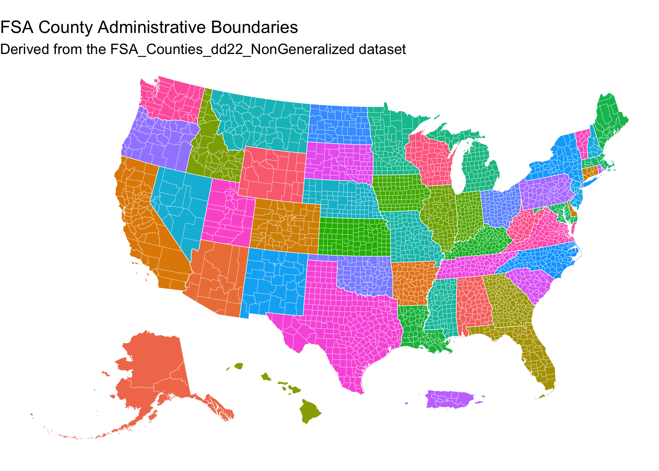
labs(title = "FSA County Administrative Boundaries",
subtitle = "Derived from the FSA_Counties_dd22_NonGeneralized dataset") +
theme_void()
📌 Background
The dataset originates from the dd22 schema, a geospatial data standard used by the USDA Farm Service Agency (FSA) for structuring county-level datasets. It serves as a spatial index for county-level geospatial products and is used in conjunction with the Common Land Unit (CLU) framework. The “NonGeneralized” designation indicates that this version contains full-resolution boundary geometries, as opposed to simplified versions used for cartographic display.
The dataset remains of historical and analytical interest — particularly for referencing USDA program boundaries, disaster assistance eligibility, and other geospatial analysis across agriculture and conservation.
📜 Citation
If using this data in published work, consider citing it as:
USDA Farm Service Agency. FSA_Counties_dd22_NonGeneralized Geospatial Dataset. Obtained via FOIA request 2026-FSA-03465-F. Accessed via GitHub archive, YYYY.
📄 License
Data in the FSA_Counties_dd22_NonGeneralized.gdb.zip archive were
produced by the United States Department of Agriculture (USDA), which
are in the public domain under U.S. law (17 USC § 105).
You are free to:
- Use, modify, and distribute the data for any purpose
- Include it in derivative works or applications, with or without attribution
If you modify or build upon the data, you are encouraged (but not required) to clearly mark any changes and cite this repository as the source of the original.
No warranty is provided. Use at your own risk.
The derivative fsa-counties-dd22.topojson file was created by R. Kyle
Bocinsky and is released under the Creative Commons CCZero
license.
The fsa-counties-dd22.R script is copyright R.
Kyle Bocinsky, and is released under the MIT License.
⚠️ Disclaimer
This dataset is archived for reference and educational use. It may not reflect current administrative boundaries and should not be used for official USDA program administration. Always consult the USDA or state FSA office for current data.
👏 Acknowledgment
This work is part of the Enhancing Sustainable Disaster Relief in FSA Programs: Non-stationarity at the Intersection of Normal Grazing Periods and US Drought Assessment project. It is supported by US Department of Agriculture Office of the Chief Economist (OCE), Office of Energy and Environmental Policy (OEEP) funds passed through to Research, Education, and Economics mission area. We also acknowledge and appreciate the assistance of the USDA Climate Hubs in securing these data.
✉️ Contact
Please contact Kyle Bocinsky (kyle.bocinsky@umontana.edu) with any questions.